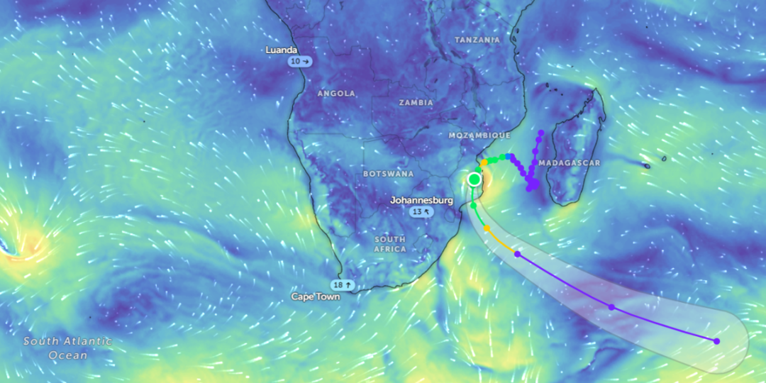
The low-pressure system between Madagascar and mainland southern Africa that intensified into a moderate tropical storm has made landfall.
“The storm is expected to affect mostly the southern parts of Mozambique, but some of its effects will also be felt over the extreme north-eastern parts of South Africa,” the South African Weather Service (SAWS) said in a press release.
For much of the southern Mozambican coastline, there is a high risk of weather-related damage from a combination of torrential rain, strong, damaging winds (with wind gusts well more than 100kph) as well as storm surge near the coastline, said the SAWS.
Meanwhile, modelling estimates by the Regional Specialised Meteorological Centre (RSMC) in La Réunion suggested that storm surges would likely elevate local sea levels by as much as 50cm (half a metre), especially along the coastline extending from Beira, southwards to Vilankulos.
Filipo will continue to pass inland through southern Mozambique, parts of South Africa and Eswatini, with heavy rainfall and strong winds expected over the next 72 hours, according to a press release from Relief Web disseminated on March 12.


